Walkability: Creating great cities by putting pedestrians first
Walkability is both an end and a means, as well as a measure… After several decades spent redesigning pieces of cities, trying to make them more livable, and more successful, I have watched my focus narrow to this topic as the one issue that seems to both influence and embody most of the others. Get walkability right and so much of the rest will follow. – Jeff Speck
The healthiest, wealthiest, most sustainable and vibrant communities in cities around the world are unique in many ways. But there is one factor above all others that these communities have in common: they are, nearly without fail, highly walkable places.
There is good reason for this. Every day, every one of us is a pedestrian. No matter where we are going or how we choose to get there, every journey begins and ends with a walk. But by creating places that are built for walking, we flick a switch that unlocks the best our cities can offer us and creates communities that are healthier and richer in every way.
What is walkability?
Simply put, a walkable community is one where residents can reach a wide range of amenities — grocery stores, doctor’s offices, restaurants, drug stores, parks and schools, safely and easily by foot. It is also, importantly, a place where the built environment — the collection of streets and buildings and public spaces that make up the city’s landscape — encourages them to do so.
The built environment can do this in many ways, and there are various guidelines for what walkable design means. You’ll see some of these discussed below. But Jeff Speck, author of Walkable City: How Downtown Can Save America, One Step at a Time boiled it down to the simplest principles when he wrote that a walkable place is one where a walk is four things: useful, safe, comfortable, and interesting. That means that walkability is about more than just building sidewalks so that people can walk (although yes, sidewalks are important too!), it’s also about creating places where people want to walk.


For centuries, when our feet were our main form of transportation, cities were naturally walkable places. However, for the past several decades our cities have instead been built around and for the automobile and the vast distances it can travel in a short amount of time (at least in theory — in reality today, they are likely stuck in traffic!) Now, cities have spread to the point that most day-to-day destinations are too far, too disconnected and too unpleasant for us to traverse them on foot. Walkability is about intentionally re-thinking how we are designing our communities to put the pedestrian first.
There is no single recipe to create communities that are more walkable. There are, however, a few key common attributes. Some of the basics include:

– A fine-grained network of well-connected streets. Where block sizes are big or where the street network is made up of discontinuous cul-de-sacs, as seen to the right, it often takes too long and is just too inconvenient to walk anywhere on a regular basis.

Vancouver planner Michael Gordon dubs a good downtown sidewalk one wide enough for two couples strolling arm-in-arm to pass each other. Image credit: marcus-e, Flickr
– People-friendly urban design, which includes safe, comfortable, direct and attractive walking routes separated from motor vehicle traffic. In addition to the quality of the walking infrastructure itself — sidewalks that are even, continuous and sufficiently wide — the surrounding street environment plays a major role in encouraging or discouraging walking. Things such as shade and weather protection, good lighting, benches, bus shelters, street trees and public art make the street more attractive for walking. Streets lined with many doors and windows, as opposed to long, blank façades, keep the walk interesting and engaging. This encourages people to walk further. They also provide “eyes on the street,” as they were dubbed by famous urbanist Jane Jacobs; people looking out their storefronts or front windows can keep an informal eye on the neighbourhood and deter criminal activity.
– A rich diversity of amenities, such as groceries, child-care, libraries, gyms, dry-cleaning and restaurants, located within close proximity to each other, along with high employment and population density. The more people and jobs that are located closely together — especially in neighbourhoods with that rich mix of amenities — the more destinations will be within walking distance for more people.
– Good cycling and transit connections. Walking, cycling and transit are mutually supportive modes of transportation that need to work together to create more walkable communities. These modes help to extend the reach of people on foot and reduce the need to drive. (See the Networks chapter for much more on this.)
There are plenty of examples of neighbourhoods with some, but not enough of the elements of walkability to make them truly walkable.
For example, a neighbourhood might have wide tree-lined sidewalks and attractive parks that make for pleasant walking. If there is no mix of shops and services nearby however, there is nothing of note for people to walk to outside of taking recreational strolls. A great example of this is Laguna West, a master-planned New Urbanist community in California. As you can see and explore in the map below, Laguna West was built with slow streets and wide sidewalks intended to encourage walking. (See the original New York Times description of the community here). However, it was originally built to be serviced by light rail into Sacremento. When that investment didn’t come through it was rendered, in the words of famous urbanist Sir Peter Hall, “as completely power-dependent as any track suburb you could find.”
Likewise, a higher density neighbourhood of townhouses or towers might be located right next to a major regional mall with plenty of shops and services. However, if the street network is not well-connected, distances may still be too great for most people. If that mall is on a busy road with narrow sidewalks and surrounded by large-surface parking lots, most people will find it unpleasant or unsafe to walk, even if they do live nearby. A great example is this tower development directly next to Square One Mall in Mississagua, Ontario, below. (Towers can be seen on the east and south side of the mall, as well as the north, across the highway, made more visible by their long shadows).
Ultimately, there is no one magic bullet or secret ingredient to creating more walkable communities. Instead, all of these ingredients need to work together.
‘Get it right, and the rest will follow’

In 2013, not a single state in America had an obesity rate of under 20 percent. Source: Centres for Disease Control
It’s no secret that many of our cities are facing major environmental and social problems. Especially in North America, diseases of inactivity like obesity and diabetes have reached crisis proportions; municipalities are going bankrupt; housing markets have crashed; we continue to pollute our air and are already feeling the dire effects of climate change; and we’re more disconnected from our neighbours and communities than ever before. While all of these problems are complex, many of them stem quite directly from the way our cities have been built and how they are shaping our lives. By building more walkable communities, we actually tackle many of these problems all at once, while creating vibrant and beautiful places to live.
Health
Low impact, appropriate for all ages and free of charge, walking is a particularly accessible form of physical activity. Walking one mile in 20 minutes burns about the same number of calories as running one mile in 10 minutes, and has been shown to significantly reduce the risk of becoming overweight or obese.
And when it comes to all other elements of our health, walking is a wonderdrug. While the typically recommended daily dose is a minimum of 10,000 steps, or about 30 minutes, benefits can be seen well below this limit. Studies have found that moderate amounts of walking lead to a significant reduction in heart disease, cancer, lung disease, diabetes and pain from arthritis. It reduces stress, anxiety and depression, and improves sleep, creativity, memory and cognitive performance for children as well as older adults.
The problem is that we just don’t do it enough anymore. Over 80 per cent of Americans today commute to work by car, compared to three per cent who walk, and under one per cent who bike. In 1969, 48 per cent of children walked or biked to school, compared to 13 per cent in 2009, a decline that has contributed to more than a ten per cent increase in obesity rates amongst youth.
The built environment can have a significant effect on this. Many studies have shown that the more walkable a community is, the more people will walk.
A study published by the University of British Columbia’s Active Transportation Collaboratory shows that residents living in highly walkable neighbourhoods are half as likely to be overweight than residents of unwalkable neighbourhoods. In fact, every additional grocery store within a one-kilometre distance from an individual’s residence corresponded with a whopping 11 per cent reduction in the likelihood of being overweight. Proximity to public transportation, a key element of walkability, has been found to have similar results.


Show The Walking Revolution in your community
Housing value and economic productivity
Highly walkable neighbourhoods are not only healthier — they are wealthier. Studies have shown that land and house value is not only higher in walkable neighbourhoods, but also retains its value considerably better than housing in places that are more auto-dependent. Economist Joe Cortright found that even minor increases in walkability had an enormous effect. Every one-point increase a property had on Walk Score, a now-standard walkability rating system in North America and Australia which rates walkability on a scale of 1-100, was associated with a $700 to $3,000 increase in value. That means that a ten-point increase in walkability, the difference between a neighbourhood where some errands can be accomplished by foot and a neighbourhood where most errands can be accomplished by foot, could add $30,000 to the price of a home. Those homes’ values also maintain consistency, and are more resilient to market fluctuation. In Arlington, Virginia and the District of Columbia, for example, houses in urban neighbourhoods lost only about 20 per cent of their value during the 2008 crash, compared with houses on the suburban fringe which lost about half.


This shouldn’t come as a surprise when we consider that the average cost of automobile ownership rings up to about $9,122 (USD) per year. The more we drive, the more we pay. Walking on the other hand, is free. While housing may appear cheaper in less walkable places, when we factor transportation into the calculation, those who live in walkable places typically pay considerably less in combined costs.
This savings on transportation translates directly to a wealthier city overall.
In one of Cortright’s research papers, The Green Dividend, he explains how the residents of Portland collectively saved more than $1 billion by living in this highly walkable and bikeable city — disposable income which was considerably more likely to flow directly back into the local economy.

Walkable, mixed-use developments generate more tax revenue for municipalities. Source: Joe Minicozzi, Urban 3
Walkable neighbourhoods, where blocks are lined with small-scale storefronts rather than auto-centric big-box supercenters, also net as much as ten times tax revenue per acre for municipalities.
Environment
The average North American vehicle emits nearly half a kilogram of carbon dioxide per mile. In most North American households, private vehicle use accounts for the vast majority of greenhouse gas emissions — more than 60 per cent of household emissions in Canada, and nearly 25 per cent of all emissions in the United States. So when Jeff Speck noted in Walkable City that moving to a walkable neighbourhood saves as much energy in a week as switching every lightbulb in one’s house to an energy efficient bulb would save in a year, he wasn’t kidding.
There is also an inseparable link between walkability and air quality; one study in King County, Washington found that a 5.5 per cent decrease in air pollutants caused by motor vehicles corresponded with a five per cent increase in walkability.
Equity, Social Cohesion and other ripple effects
There are other less tangible effects walkability has on the overall well-being of a community. People living in walkable neighbourhoods see their neighbours more often, and are more likely to know and trust them, which corresponds to higher levels of health, life satisfaction and community engagement. Compared to their counterparts in auto-centric neighbourhoods, they are more likely to vote or be otherwise politically engaged, and more likely to get involved in community groups; all of which leads to higher levels of community resilience.
Walkable neighbourhoods are also more equitable, meaning that those who can’t afford to own cars have better access to essential services such as health centres, and also to community centres, parks, public spaces and the many other riches the city offers.
How walkable is your city?


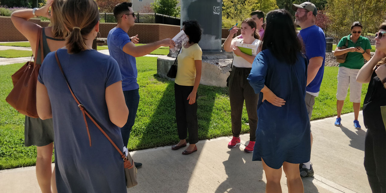
The best known tool for measuring walkability, Walk Score, allows users to punch in any address in Canada, the United States or Australia and receive a rating, on a scale of 1-100. Walkability expert Dan Burden also developed and advocates strongly for communities to partake in what he calls a walking audit, where groups go out and assess the walkability of a place themselves by looking at many elements of a place’s physical design. He produced a free walking audit toolkit and slideshow presentation for anyone wishing to conduct one in his or her neighbourhood. Jane’s Walk has produced a similar checklist tool, and many others of varying levels of technical sophistication are currently in development.
But perhaps the best measurement of all is the simplest: whether or not there are people out walking in the street. If so, it is likely a place that possesses some, if not all of the elements of walkability. A walkable place, above all, is one where people walk.
This chapter is available as a PDF: Download a copy.
Lede image credit: Walk [Your City]
More stories

Jane Jacobs. Image via Wikimedia Commons
“A city street equipped to handle strangers, and to make a safety asset, in itself, our of the presence of strangers, as the streets of successful city neighborhoods always do, must have three main qualities: First, there must be a clear demarcation between what is public space and what is private space. Public and private spaces cannot ooze into each other as they do typically in suburban settings or in projects. Second, there must be eyes upon the street, eyes belonging to those we might call the natural proprietors of the street. The buildings on a street equipped to handle strangers and to insure the safety of both residents and strangers, must be oriented to the street. They cannot turn their backs or blank sides on it and leave it blind. And third, the sidewalk must have users on it fairly continuously, both to add to the number of effective eyes on the street and to induce the people in buildings along the street to watch the sidewalks in sufficient numbers. Nobody enjoys sitting on a stoop or looking out a window at an empty street. Almost nobody does such a thing. Large numbers of people entertain themselves, off and on, by watching street activity.” – Jane Jacobs, The Death and Life of Great American Cities

The entire walking audit toolkit, along with many other open-source resources, slide show presentations and more are available for download on the Walkable and Livable Communities Institute website.

“A growing number of researchers agree that social networks and community involvement have positive health consequences. Persons who are socially engaged with others and actively involved in their communities tend to live longer and be healthier physically and mentally. Social and community ties are key components of a more encompassing concept, social capital. Social capital is defined as the social networks and interactions that inspire trust and reciprocity among citizens. Individuals with high levels of social capital tend to be involved politically, to volunteer in their communities, and to get together more frequently with friends and neighbors. They are also more likely to trust or to think kindly of others. Social capital has been found to be linked to more than just good health; empirical linkages have been found among social capital, the proper functioning of democracy, the prevention of crime, and enhanced economic development.”
– Kevin M. Leyden, “Social Capital and the Built Environment: The Importance of Walkable Neighborhoods,” American Journal of Public Health. Read the full report here.

Urban planner, real estate analyst and consultant with Urban 3, Joe Minicozzi found that walkable, mixed-use developments netted the city of Ashville nearly ten times the property tax revenue and twice the retail taxes as a nearby bix-box Walmart. He writes:
“If you were a mayor or city councillor facing a budget crisis, this comparison should serve as an eye-opener, both in terms of your policies and your development priorities. The comparison should also get you thinking about not just how you could encourage more downtown development, but also what kind of development could increase the value of buildings in the surrounding neighborhoods.
It’s not just officials in Asheville who should be asking these questions. In the growing number of diverse cities where we have studied this same equation (such as Billings, MT, Petaluma, CA, and Sarasota, FL) we’ve found that the same principle applies: downtown pays. It’s simple math.
For comparison, let’s consider an everyday example of measuring economic value. When we buy our cars, do we make our buying decisions based on the vehicle’s miles-per-tank rating? If we did, we’d all be driving Ford F-150 Lariats that get, on average, 648 miles per tank versus a Prius, which boasts a modest 571 miles per tank. However when we look at the traditional metric for comparison — how many miles-per-gallon each vehicle gets — the value statement changes. The Lariat achieves a mere 13 miles- per-gallon while the Prius cruises along at 51 MPG. And, since you spend less to fill up the Prius, at today’s gas prices it covers 15,000 miles/year at $3,000 less the annual cost ($4,038/$1,029 respectively). We rank the value of our cars this way because we all know the price of a gallon of fuel. Why wouldn’t we do the same with our land? Shouldn’t we value the consumption of our land the way we value a gallon of gas? After all, an acre of land is far more expensive than a gallon of gas.”
Minicozzi works throughout North America doing similar assessments of land value efficiency. See his assessment of Austin, Texas in the video below.
Graphic source: Joe Minicozzi, Urban 3


The H+T Affordability Index paints a vivid picture of the true cost of living in automobile-oriented communities by comparing the cost of housing alone to the combined cost of housing and transportation.
In the map of Minneapolis above, you see that housing costs alone, pictured on the left, are more affordable on the suburban fringes (yellow = < 30% of average annual income, blue = 30%+). When the costs of transportation are factored in, however, as they are in the map on the right, only the denser downtown core remains in the realm of affordability (yellow = <45%, blue = 45%+).
The H+T Affordability Index allows you to punch in any location in the United States to see similar data.


The Walking Revolution, a compelling summary of the health benefits of walking, is produced by the health campaign Everybody Walk! The film is free to show at advocacy and education events, and comes with a complete dialogue guide to help conduct discussion sessions after the film. Learn more here.

Access to transit immediately boosts the likelihood that a neighbourhood’s residents will get the daily recommended amount of physical exercise. One study found that having access to light rail transit corresponded with a decrease in body mass and a whopping 81 per cent reduction in the risk of becoming obese over time. Read the full report here.
Image credit: writ RHET, Flickr

The same study, conducted by researchers at the University of British Columbia found that residents of Metro Vancouver living in the most walkable and most connected (measured by intersection density) neighbourhoods of the city were half as likely to be overweight than those in the least walkable and connected neighbourhoods; that people living in areas with the highest ratios of retail floor areas and least distance between the street and retail spaces were half as likely to be overweight than those living in neighbourhoods where retail is set back behind surface parking lots; and that living in a neighbourhood with at least one grocery store corresponded with nearly 1.5 times the likelihood of getting sufficient physical activity. Read the full summary here.
Image credit: Prayitno, Flickr
Each additional kilometre walked per day has been found to be associated with a 4.8 per cent reduction in an individual’s probability of becoming obese, whereas each hour spent driving was associated with a 6 per cent increase in an individual’s probability of becoming obese. Source: C3 Collaborating for Health

The benefits of regular walking for health, well‐being and the environment, produced by the C3 Collaborating for Health initiative in 2012 is by far the most comprehensive and rich overview of the many health benefits of walking, including impacts on non communicable diseases, physical and mental health and all cause mortality. It also contains information on overcoming barriers to walking and the impact of active transport and walkable environments as well as many case studies.
Read the full report here.

This once-interactive map of foreclosures no longer lives on the Houston Chronicle’s website, but an image of it remains incredibly poignant. The bigger and darker the circles are – the further you move away from the city centre into auto-centric suburbs – the more foreclosures there were. These maps looked the same all across America during the foreclosure crisis: the cities hit hardest by the crash, like Stockton, Riverside and Bakersfield, California, Las Vegas, Nevada and Fort Lauderdale, Florida, were among the most sprawling and least walkable.
There are dozens of examples of this, but one comprehensive report done by a University of Ottawa-based research network found that in the auto-centric city of Edmonton, development charges wouldn’t even come close to the long-term cost the city would incur as a result of its sprawling suburbs. Researchers wrote:
“In Edmonton, for instance, the City picks up all the capital costs of fire and police stations, and portions of some roads and recreation facilities. It also covers all the costs of maintenance, repair and renewal of the infrastructure, including pipes and roads. The costs to Edmonton of new suburban developments will exceed revenues – by a very large margin. Across just 17 of more than 40 new planned developments, costs to the City are expected to exceed revenues by nearly $4 billion over the next 60 years.”
Many municipalities throughout North America face this same dire situation. Read the full report here.


Charles Montgomery describes this phenomenon with an amalgamation of research in Happy City:
“Aesthetics matter. We walk further when streets feel safe and insteresting. People who live in New York or London typically walk between a third to half a mile to go grocery shopping. Even in Montreal, with its freezing winters and sweat-soaked summers, people report walking about a third of a mile (six to eight minutes) between shops, bags in tow. The numbers are almost as high for people arriving at enclosed shopping malls, which mimic the downtown experience, at least once you’re in the building. But dump us in a vast parking lot surrounded by big-box outlets, and our inclination to walk evaporates. Even when people are equipped with shopping carts, they won’t endure so much as a three minute stroll between retailers. Researchers observed that a third of the shoppers at one Canadian power centre actually parked their cars three or more times during one visit. They just hated trudging across the asphalt desert. It felt ugly, uncomfortable, and unsafe.”
Image credits: Shuichi Aizawa, Flickr (left) and Lindsay Turner, Flickr (right)


At the BMW Guggenheim Lab in New York City, Happy City author Charles Montgomery and environmental psychologist Dr. Colin Ellard conducted an experiment that tested people’s emotional and physiological responses to various types of street façades. They found that people felt happier and more aroused (the technical term environmental psychologists use to describe a general feeling of activation, excitement, and engagement) standing in front of a more active street front, such as the one seen above on the left, than they did standing in front of the blank façade of Whole Foods on Houston Street, on the right. The contrast was even stronger in visitors to the neighbourhood and city than it was with local residents. This same effect was found in other cities around the world. See the full study here.
These findings reflect established wisdom and study. In 2003, a Danish architect and urbanist found that people moved 13 per cent slower when walking along a sidewalk with an active frontage compared to a blank façade; they were considerably more likely to stop or take a phone call (25 per cent compared to 1 per cent) or turn their heads toward the façade (75 per cent compared to 21 per cent). “…we find the most compelling arguments for promoting well-conceived ground-floor policies: the variety of experiences and the sheer pleasure of journeying through the city. What we need to do is encourage and insist on freedom of movement for pedestrians in their own city. Façade policy also addresses the issue of urban security,” he concluded. See the full study here.
Image credits: Charles Montgomery

Image Credit: Ash Kelly
When considering walking distances, it is important to consider the actual walking distance on the network, rather than measuring as the crow flies. For example, you can see in the image above on the right hand side that someone might live only 175m from a grocery store or a transit stop but would need to walk 1000m, or 12 minutes, around winding and disconnected streets to get there. In contrast, in the neighbourhood on the right, someone might live the same 175m from the grocery store or the transit stop but because there is a fine-grained network of well-connected streets and pedestrian paths, they only need to walk 265m, or 3 minutes.
As seen in the maps below of two neighbourhoods in Atlanta, Georgia, these pattern deeply impact on how much of a neighbourhood is within reach or accessible to someone on foot.
Image Credit: Charles Montgomery, Happy City

The traditional grid of older cities that developed in the era of the streetcar typically have main streets spaced about 800m apart and short local blocks. In very walkable downtown Portland, for example, block sizes are only 200 ft long. In many newer, more automobile-oriented communities, blocks can be closer to 800 ft. See a larger version of this graphic here.

Though most Americans acknowledge that they should walk more, their neighbourhoods prevent them from doing so. Forty per cent of Americans say they don’t walk as much as they should because their neighbourhoods aren’t walkable enough.
Study and graphic design by Everybody Walk! See the full report here.